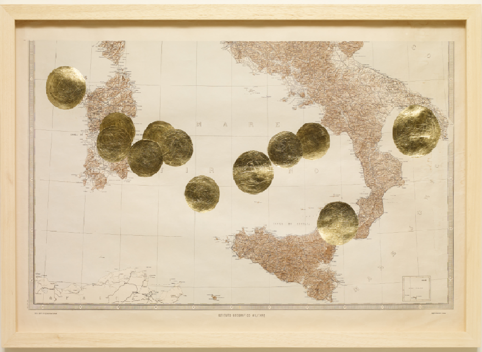
Appropriating a series of historical maps that date from 1930 to 1957, conceptual artist Giulia Piscitelli explores how we distinguish between land and sea, borders and territories, and how in this way we create and define a sense of self and other.
Gold-leaf discs are overlaid onto Piscitelli’s maps, copying the position of saints’ haloes from Early Renaissance altarpieces, which in their original church settings provided a visible means for viewers to distinguish between the divine and earthly realms. Political geography, like other belief-systems, shifts and changes over time. Through the absence of saints’ bodies in the artist’s appropriated maps, Piscitelli highlights how man-made constructs affect collective understanding, be those beliefs faith-based and spiritual, or political and earthly.
As a port-city, Hull’s collections are defined by its maritime heritage. Piscitelli’s recent map works resonate by bringing new, multi-layered perspectives and a contemporary slant to the city’s complex interactions and relationships with the sea. In this acquisition for Ferens Art Gallery, a 1935 military map of the Tyrrhenian Sea evokes for Piscitelli, ‘a state of alert linked back to drownings over the centuries’ and connects with the contemporary global refugee crisis. The overlaid golden haloes reference an Early Renaissance panel painting by Lorenzo Veneziano Christ Rescuing Saint Peter from Drowning (1370), Staatliche Museen, Berlin. On a human level, Piscitelli’s concern about loss of life at sea resonates with the experience of Hull’s fishing communities. Her work also provokes thinking afresh in the context of a now largely forgotten aspect of the development of Hull, through its acceptance and absorption of migrant communities over the centuries.


